Trails
Matlock Cycle Routes - Stanton Moor circular
Testing climbs and superb views over the Wye Valley.
About
Testing climbs and superb views over the Wye Valley. This route is available to download as a PDF and GPX file at the top of this page.
Start/End Point: Matlock railway station Distance: 22.5km/14miles Ascent: 480m/1575ft Grade: Hard 100% road Cafes: Matlock, Darley Dale, Whitworth Park, Rowsley Pubs: Matlock, Darley Dale, Churchtown, Rowsley, Stanton in Peak, Birchover, Winster Shops: Matlock, Darley Dale, Rowsley, Winster.
This route was developed as part of the Pedal Peak for Business initiative, funded by the European Regional Development Fund.
Trail directions
With Matlock Railway Station on your left, follow the on pavement cycle way (NCN 680). Cross the access road to the car park and use the crossing at Cawdor Way. Follow the cycleway L at the roundabout. Past ARC leisure centre, turn left onto an access track following NCN 680 signs.
Cross the railway line to the far side and follow path. Exit through a gate and turn left onto the road. Turn right at the crossroads. Follow blue signs over level crossing then turn left into Whitworth Park through gate. Follow blue 680/WPL signs through park. Bend left at the far end of a football pitch then sharp right as footpath joins from the left.
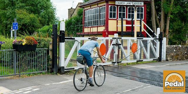
Cross Church Lane adjacent to the level crossing and continue on cycleway beside the railway. Slow down near the Derwent Lane footpath access to the railway terminus which can be busy at peak railway times, then veer slightly right through a tree lined section below the road. Cross Harrison Way (take care). Follow blue signs left then along the track running parallel to the recycling centre. Pass a wooded wetland area, cross boardwalk and a small industrial works to reach Rowsley car park.
Left out of car park then left onto A6. Cross River Derwent then turn left towards Stanton in Peak. After crossing the river follow the road as it bends sharply to the right and climb steeply. Continue straight ahead over a minor crossroads towards Stanton in Peak.
Turn left at the T-junction in Stanton in Peak near the church. Bear right towards Birchover. Stay on this road and descend steeply on a narrowing road to Birchover.
. Turn left into Uppertown Road. Continue straight ahead, descending a very steep, tree-lined “sunken road” and pass the access to Whiteholmes Farm. Turn left out of Birchover Lane. This narrows and bends sharp L into Winster. Immediately on the sharp left bend, turn right onto West Bank. Turn left onto a busy road (B5056) opposite the Miners Standard public house.
Turn left onto Bonsall Lane. Descend (steeply) through Brightgate, then turn left (easily missed). Descend (increasingly steeply on this very narrow holloway – take care) down to the edge of Matlock. As the road bends sharp left, turn right onto Salters Lane and ride between bollards. This descends steeply down to the traffic-light controlled junction outside the railway station. Turn left back to start.
Sign up to our newsletter
Receive the latest news, special offers, ideas and inspiration straight to your inbox by signing up to the Visit Peak District & Derbyshire e-newsletter.
