Trails
The Limestone Way
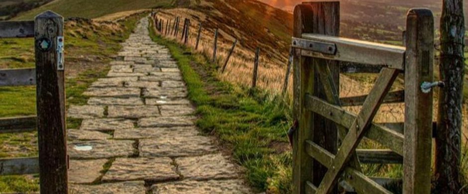
The Limestone Way is a superb 46-mile waymarked route across the White Peak landscape of the Peak District National Park.
About
The Limestone Way is a superb 46-mile waymarked route across the White Peak landscape of the Peak District National Park. The walk is waymarked and shown on OS maps (OL1, OL24 and 259). Starting from Castleton in the Hope Valley the route passes through the dramatic dales and green rolling landscape of the Derbyshire Dales to Rocester on the banks of the River Dove in Staffordshire. Enjoy this trail walk over several days, taking in the spectacular scenery and views along the way. The route passes through several picturesque villages, with cafes and pubs on the way for refreshments, plus an optional detour to the former spa town of Matlock.
Not sure whether this one is for you, read about HikerHero's experience in his latest blog here. Mike sums up the route perfectly 'Four days of endless rolling hills and dales, streams, rivers, bunting, village fetes, sheepdogs and more stiles and dry stone walls than you can swing a hiking stick at.'
For more information see www.derbyshiredales.gov.uk/limestoneway
Trail directions
From the centre of Castleton walk up the hill past the War Memorial. Take the track on the right up Cave Dale, signposted as the Limestone Way. This rocky limestone track eventually turns to grass at the head of the dale below Peveril Castle. Continue on and pass through a hand gate and the path leads across fields to a lane.
Continue directly on the bridle road to the next field boundary. Just before a gate bear left over a stile; keep the wall on your right to a walled track, which eventually leads to The Cop and onto a minor road. Where the road turns right continue on over a stile along Green Lane to the junction with the A623 at Mount Pleasant Farm. Carefully emerge onto the main road, go left along the verge and cross to Wheston Road on the right.
Follow road for 1 km, past the appropriately named Limestone Way Farm, and turn right on a limestone track. At the bottom of the dale where track bears right go over a stile and down a tree lined path leading into Hay Dale.
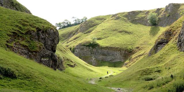
At the next road bear right then left after approximately 40m and into Peter Dale. Like many limestone dales, this may be flooded at times in winter. Continue down the dale to meet another road.
Turn left up the steep hill to reach Monksdale House. Go right down Monksdale Lane on a narrow walled track. Bear right at junction after 750m. After a further 1km enter the farmyard through a gate and bear right down hill to a minor road. Turn right along the road under two most impressive viaducts (once carrying the Buxton to Matlock railway, now the Monsal Trail). There is no footway on much of this section of road.
200m past the junction an unclassified road leads off to the left at a bend on the main road. After approximately 1.5km uphill (you’ll know why its called Long Lane!) go straight ahead at the road for 150m, then turn right at crossroads to the A6 and the Waterloo Inn. Continue on Sough Lane (the track to the left of pub) uphill 1.5km to a minor road. Parts of this path may be extremely Near Priestcliffe Ditch muddy in winter months.
Turn right along road then left at the junction. Another 2km of pleasant road walking brings you to the village street of Flagg. The field walls hereabouts are some of the best examples in the Peak District landscape.
At the end of the street turn right at the junction and where the road bears sharp right continue along a farm track towards Knotlow Farm. After about 250m take the well waymarked path to the right. Cross two fields, avoiding the farm to rejoin the walled track. At a barn bear slightly left and continue on the track to a minor road, eventually turning right to reach Monyash.
Go up Rakes Road opposite the village green and where the road bears sharp right carry on along a track for approximately 1km. Cross the head of Fern Dale and a succession of stiles with the wall first on your left then on your right to reach One Ash Grange. On entering the farm bear left
Descend the steep path to the next path on the right, this leads up some steps and across fields to skirt Calling Low Farm. Go through a copse then through a field to a stile. On entering a large field go diagonally to the right over the brow to another stile, then bear left to the road. Cross to Moor Lane and turn right at the car park, where a path leads to another road. Turn left then right again over a stile leading to the Youlgreave to Middleton road. Turn right and after 400m at a sharp bend go through Old stone slab bridge over the River Bradford, near Youlgreave YHA at the old Co-op in Youlgreave the gap in the stone wall and descend to Bradford Dale.
Turn left and follow the pleasant riverside path approximately 1.5km to a road
Where the Elton Road crosses the river go right for 50m to a stile on your left. Follow the path over fields, crossing Bleakley Dike, then uphill to a gate. Harthill Moor Farm can be seen above. Take the waymarked path over a stile and double back left into the wood and round to the road. Turn right uphill and take the path opposite a farm drive to reach Robin Hood’s Stride.
The path passes between Robin Hood’s Stride and Cratcliffe Rocks and on down a track to a stile at a minor road. Go straight ahead up Dudwood Lane to the junction. Cross the road and continue on a track for just over 1km to Winster Bank Top. Bear left along the road to the next junction.
Take the broad walled track opposite the Ore House. At the end of the track bear left down hill over stiles to skirt below Lun Tor Rocks and up again following a wellwaymarked path through a succession of narrow fields. It is necessary to bear diagonally right over the final large field to reach Bonsall Lane. Turn left along the road for 80m and take the stile on the right diagonally across fields to Blakelow Lane. Turn right then almost immediately go through a stile on the left. Strike diagonally right through stiles to reach Moorlands Lane.
Turn left on Moorlands Lane for approximately 300m. Ignore the first footpath on the right and take the second waymarked path. Follow the path through a succession of stone squeezer stiles to an old building. Bear right on the path towards Bonsall Uppertown, which is in sight. On joining the road go straight past Hollies Farm Shop to the crossroads at the top of Bankside.
Turn right down Bankside and continue downhill to the postbox at the junction with Horsedale. Take the path up the bank to the right of the Chapel, bearing half right to reach a walled track. Go uphill, then straight ahead through a series of stiles, before crossing rough pitted ground to carefully locate a crossing point over a deep ‘rake’. Now bear right to a stile, then half left to a road. Go ahead above Leys and Whitecliffe Farms, and through closely spaced stiles, before dropping to the road into Ible. Turn right along this road.
Continue on towards Grangemill, then as the road descends, take a path on the left. On reaching the lane turn left and continue to the Holly Bush Inn at the crossroads of the Via Gellia. Keep left on the pavement and cross the busy road to a bridleway
Go through the gate and follow the track to a second gate; bear slightly left skirting around the quarry boundary and through a gateway. Bear half right up a large field to a gate at the brow of the hill. Leave the bridleway and keep on uphill. Climb to further stiles on the skyline. Bear half left across the brow of the hill, descending a shallow valley, before climbing through the higher of the two field gates to cross the High Peak Trail.
Climb through stiles, before doubling back left in a rough pasture, through Roundlow farmyard to the road. Bear right a short distance to a junction above Brassington then right again uphill for 25 metres. Leave the road at a gate on the left and go through another gateway, crossing the brow of the hill to a stile, then straight across rough ground to a small gap in the wall opposite. Bear right then immediately left around a limestone outcrop. Descend to join a walled lane which then joins a minor road below Rainster Rocks. Cross the B5056 to a gate and climb a trackway to the brow of the hill. Bear left passing a solitary stone post and descend again just right of a church to the road at Ballidon
Bear left, then immediately right leaving the road at a stile. Go ahead, crossing a small brook, then bear half left to a stile. Go half left to cross another ditch, then follow the hedge on the right to the road. Bear right uphill for 250 metres to a stile on the left. Go ahead from the stile, descend crossing a brook, then climb slightly right before bearing left to enter Parwich. Go past the church, then left at a green, to the village pond.
Bear half right, climbing uphill to a stile, then ahead with the hedge on the right through two further stiles. Descend, crossing the Bletch Brook, then climb to a trackway. Follow this track left, crossing the Tissington Trail (This 21km/13 mile route runs from Parsley Hay to Ashboune). The track bears to the left to pass High Flats. Shortly after the track has led right take a stile left, crossing a lane, then ahead to a field gate. Bear half right to a stile entering the churchyard, then half left to a gate leading to a green.
Take the road to Ashbourne uphill to cross the A515. Descend the minor road, turning left off the road in the valley bottom. Climb the field, recrossing the road to bear half left through a series of squeeze stiles to join a lane just south of Pike House. Bear left, then bear right off the lane after 50m, descending through a series of stiles to emerge by the entry to the Peveril of the Peak hotel. Follow the road downhill for 300m, then descend across The Green. Bear right, up Church Lane and follow this to rejoin the road at a T junction.
Turn left along the road, then quickly fork right, descending a lane to join a track crossing at right angles. Descend the track to reach Coldwall Bridge
Cross the bridge and climb the hill, passing through a field gate and Coldwall Farm to reach the road. Cross to a squeeze stile and descend the fields ahead, climbing from the stream to a field gate just north of Woodhouses.
Descend through a gate to the A52. Cross the road and turn right, to find an obscured stile 150m on the left. Bear left through the right hand of two field gates to the foot of the field. Turn right to a stile in the corner of the field, then left to head south through a series of stiles and then gateways to the road at Lordspiece.
Cross the road to a squeeze stile then follow a path south along this ridgeway, at first parallel to the farm track, then to the left away from it. Rejoin it until almost reaching Ashfield Farm. Bear right 150m before the farm and then pass above Dydon, through a series of stiles above Gold’s Wood, to cross a stile at the southern tip of Far Wood. Bear left uphill to a gate, then follow the trackway through the Hutts farmyard to another gate. Go ahead skirting Aldercarr Wood then follow the boundary of another wood to your right, then cross open fields through a stile alongside a gate, to a gateway on the B5032. Turn right for 150m then go through a stile on the left, then go ahead to a trackway. Follow this to the left on level ground, then bear right at a pool, to reach a lodgehouse at Lower Ellastone.
Bear left towards Ellastone Bridge, then right at a stile, following the path along the riverside to Doveleys. Climb uphill to Dalesgap then cross the road carefully and descend via a footpath to the left of Barrowhill.
Cross this road, with a slight dog-leg to the right to a stile, then go straight ahead to reach a footbridge. Bear half left to join Dove Lane and follow this to the lych gate of St Michael’s Church.
Bear left along the valley, then right along West View, to reach the end of the Limestone Way where it joins the Staffordshire Way at Mill Street.
CONGRATULATIONS - YOU HAVE COMPLETED THE LIMESTONE WAY!
Sign up to our newsletter
Receive the latest news, special offers, ideas and inspiration straight to your inbox by signing up to the Visit Peak District & Derbyshire e-newsletter.